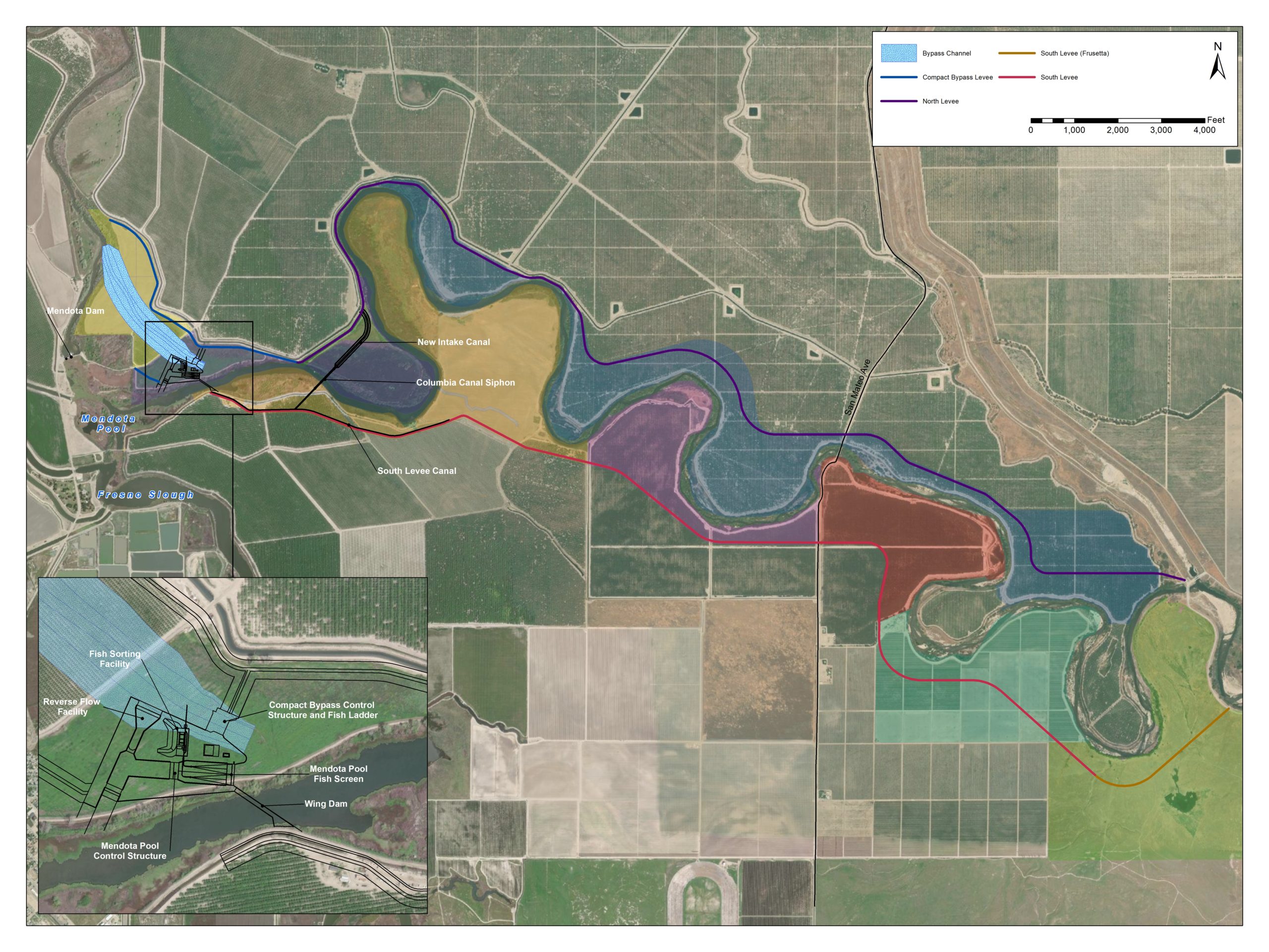
Creating a passable San Joaqin River for salmonids between Mendota Dam and the confluence with Merced River is critical for the Program. In order to accomplish this, Reclamation must provided a fishway to circumvent the Mendota Dam and Pool, a large agricultural water diversion point. The Mendota Pool Bypass and Reach 2B Project will accomplish this by creating a river-like channel over a half-mile around Mendota Pool. By doing so, the Program will meet a key goal of providing volitional fish passage so salmon and other anadromous fish can complete their lifecycle while allowing water deliveries to farms continue. Other characteristics of the project include set-back levees to create floodplain habitat. Below is a schematic map showing the Reach 2B Project.
A description of the inset, depicting the major project appurtenances:
Mendota Pool Bypass channel and levees
Provides unimpeded fish migration and 4500 cfs conveyance capacity
Reverse Flow Facility
Reduces Mendota Dam releases which causes false attraction for adult salmonids
Mendota Pool Bypass Control Structure & Fish Ladder
Enables Restoration Flow deliveries to Mendota Pool while providing upstream salmon passage
Fish Recapture Facility & Bypass Pipe
Allows for fish sampling, rescue, and downstream passage
Mendota Pool Fish Screen
Provides downstream passage for fish during Mendota Pool deliveries
South Wing Dam
Maintains Mendota Pool water surface elevation
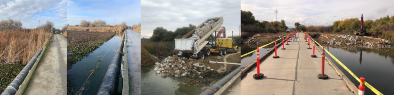
In September 2021, the Program completed the first Reach 2B construction project — the replacement of Mowry Bridge. Started a year earlier, this project replaced a condemned bridge spanning the Fresno Slough at the upstream end of the Mendota Pool. The bridge replacement serves several purposes for the Mendota Pool Bypass and Reach 2B Project including providing a haul route during construction as well as the primary operation and maintenance access point for the Reach2B control structures and the Mendota Pool Bypass. The project also provides another key benefit: a stable structure for the economically disadvantaged City of Mendota’s municipal water supply line – the City’s primary source of drinking water. The City oversaw the construction effort and key milestones are highlighted below.
L to R: Old bridge and encroaching vegetation; vegetation removal; building the crane pads.
L to R: Crane placing steel support piles for use during construction which will be removed following construction of the new bridge; attaching the old city water line temporarily to the support piles; continuing demolition of the concrete top of the old bridge.
L to R: Removing remaining concrete slabs from old bridge; starting removal of old wood structure; complete removal of an old bridge section.
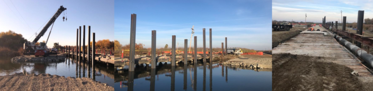
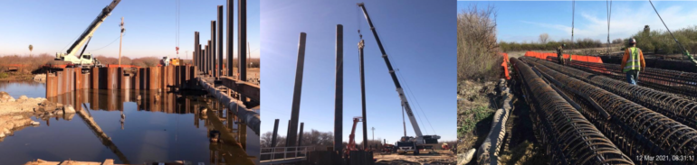
L to R: Driving sheet piling in order to create the coffer dam needed to create dry working conditions during construction; driving the bridge support piles using a vibrating crane hammer; the rebar cages that will be placed into the support piles.
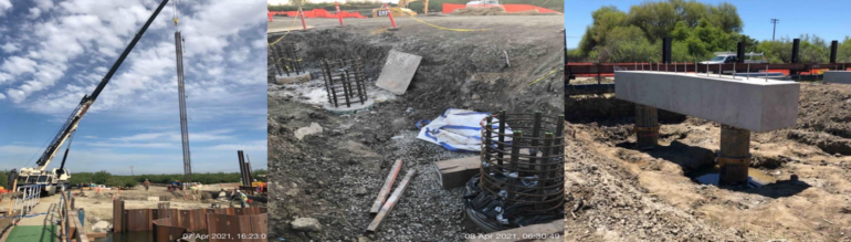
L to R: Inserting a rebar cage into a driven pile; rebar cages protrude from a pile following concrete pouring; a completed bridge support.
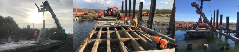
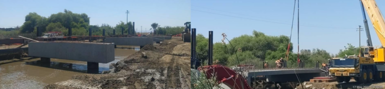
L to R: Completed bridge supports stand in the river following removal of the coffer dam; pre-cast concrete slabs lowered into place.
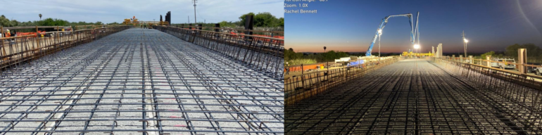
L to R: Rebar placed on the slabs; pouring the concrete deck.
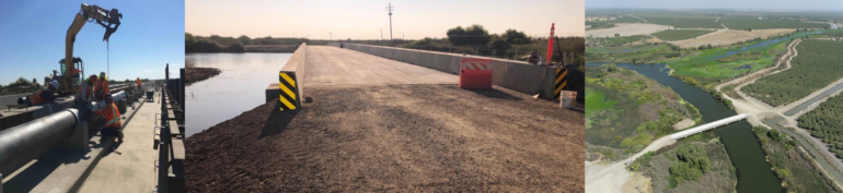
L to R: Completing installation of the new city water line; the completed Mowry Bridge; aerial view showing the completed bridge spanning Fresno Slough.
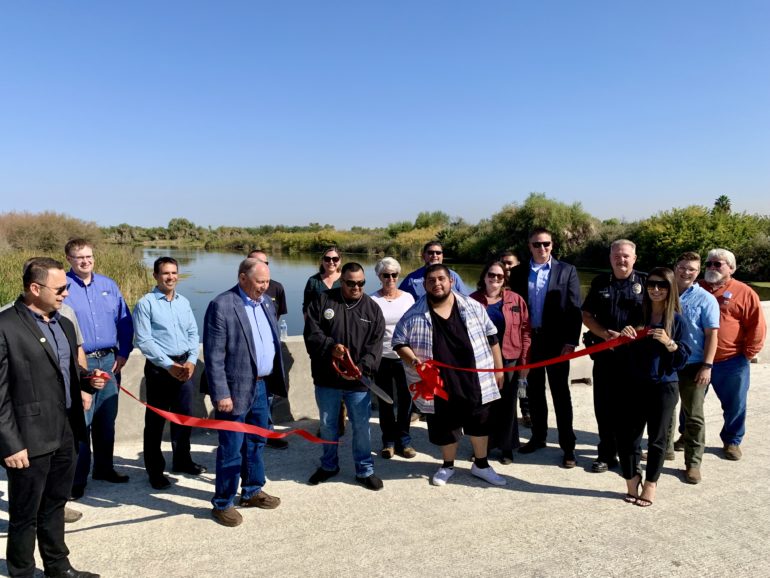
A ribbon-cutting ceremony to open the bridge, hosted by the City of Mendota, was held on September 30, 2021.
Representatives from the Program, City of Mendota and the construction team officially opened Mowry Bridge.
4/21/2017 - The State Lands Commission approved lease for the project, and issued a Notice of Determination on their CEQA findings.
Reach 2B and Mendota Pool Bypass
Highlighted Stories
First time in over 60 years: spring-run Chinook salmon spawn in the San Joaquin- December 1, 2017 Seasonal Monitoring Reveals a Program Milestone: Successful Spawning A multi-agency effort to bring salmon runs back to the San Joaquin River has proven it is possible for spring-run Chinook salmon to successfully spawn in the river – a major first milestone for the San Joaquin River Restoration Program. […]
Draft Channel Capacity Report Released-September 20, 2017 – Program Releases Draft Channel Capacity Report for 2018 Restoration Year for Review The primary objective of this report is to provide the Channel Capacity Advisory Group (CCAG) and the public a summary of the prior Restoration Year’s data, methods, and estimated channel capacities, as well as, recommendations for monitoring and management […]